Key Advantages & Technical Specifications
One of China's first commercially deployed magnetic positioning solutions · military-grade technology transferred to civilian use, validated by multiple national-level awards
🏆 Key Advantages
| Fully passive | Senses only the geomagnetic field and emits no signal — covert, zero radiation, privacy-safe |
| No construction | Uses the building's inherent magnetic characteristics — no base stations or beacons to install, just one fingerprint survey |
| Maintenance-free | No hardware requiring periodic inspection — operating costs near zero |
| Floor recognition | Distinguishes floors from vertical magnetic field characteristics, with automatic multi-floor switching |
| Obstruction-immune | Strong magnetic penetration — unaffected by walls, people or metal shelving |
| Full-area coverage | Works in every GPS-denied area: underground utility tunnels, mines, tunnels, large venues and more |
| EMI-resistant | The geomagnetic field is stable — unaffected by multipath effects, electromagnetic interference or crowd occlusion |
| Low-power terminal | Terminal power < 200mW, continuous operation 24h+ |
⚙️ Technical Specifications
| Positioning accuracy | 1~3m (typ. 2m) |
| Update rate | 10Hz |
| Cold-start fix | < 3s |
| Terminal power | < 200mW |
| Battery life | ≥ 24h (built-in lithium battery) |
| Communication | BLE 5.0 / LoRa / 4G Cat.1 |
| Terminal size | Ultra-thin; integrates into badges / helmets |
| Ingress protection | IP67 |
| Operating temperature | -20℃ ~ +65℃ |
| Network capacity | 1000+ terminals per gateway |
Magnetic Positioning Products
Fully passive positioning terminals — no base stations to deploy, ready out of the box
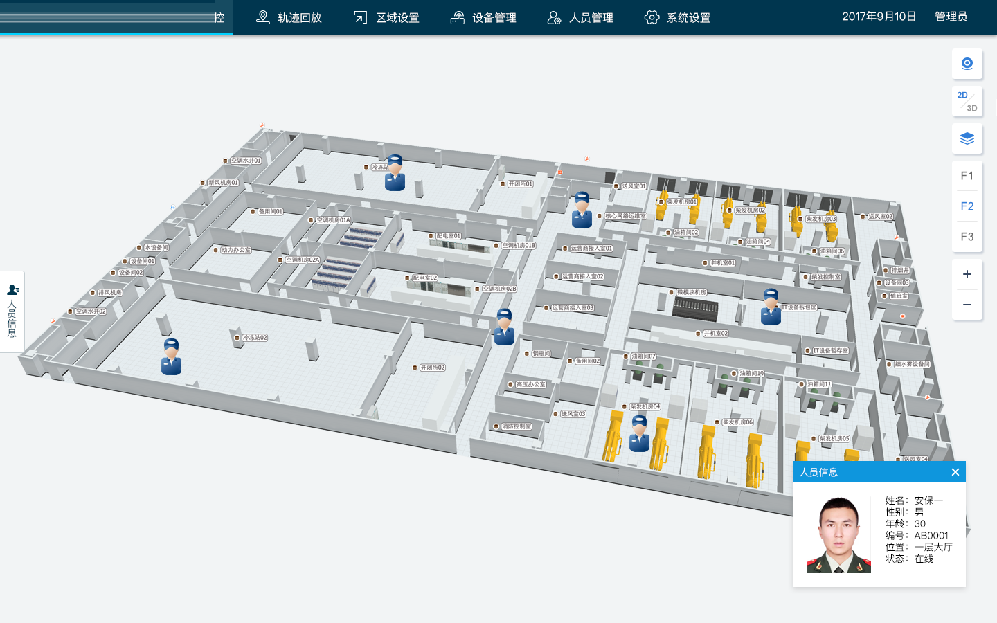
Application Scenarios
Field-proven in demanding environments such as power plants, chemical plants and warehousing & logistics, with continuous, stable and reliable positioning
Power Plant / Chemical Plant Personnel Positioning
Real-time positioning of workers in high-risk zones, geofencing, boundary-crossing alarms and emergency evacuation guidance. Field-proven with continuous, stable and reliable results
Warehousing & Logistics Vehicle Positioning
Real-time tracking of forklifts, AGVs and other in-plant vehicles, with flow analysis, collision warnings and dispatch optimization
Underground Mines / Utility Tunnels
Precise positioning and trajectory tracking for inspection personnel in mines, tunnels and utility corridors, with abnormal-event location alarms
Exhibition Halls / Shopping Malls
Visitor navigation, heatmaps and footfall analytics inside venues, improving smart venue / mall operations
Public Safety & Emergency Response
Real-time tracking of firefighters / rescuers inside fire scenes and rubble, with safety warnings — applicable to a multibillion-RMB public safety market
Smart Construction Sites
Precise positioning of site workers and machinery, restricted-zone control, geofencing, productivity analysis and flow optimization
Field Case
Typical application validation of MagNav PDR technology in a power plant scenario
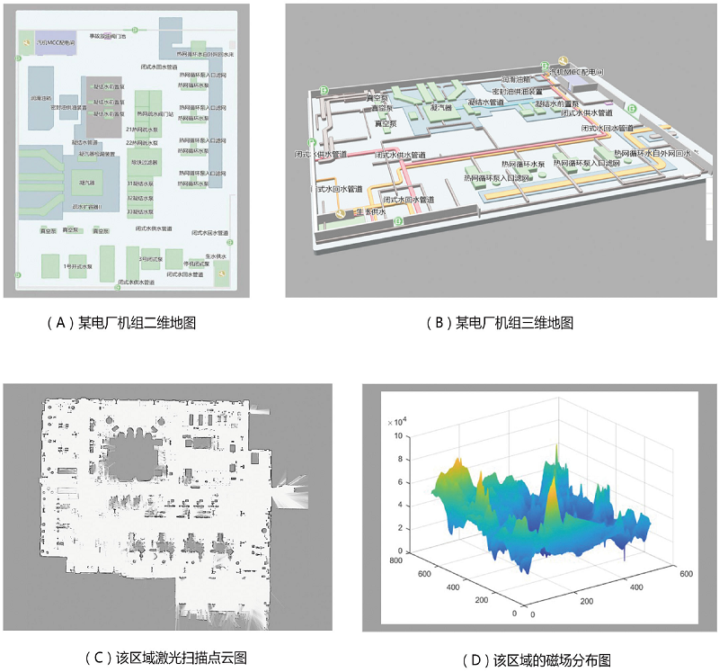
🏭 Magnetic Mapping of a Power Plant Steam Turbine Hall
At the 0 m level of a power plant's steam turbine hall, surveying and mapping covered 10,000 square meters — the full-area map collection and magnetic field database were completed in just 2 hours.
📺 Mapping & Positioning Field-Test Video
📸 Mapping Results
Fig. (A) 2D map of the turbine hall · Fig. (B) 3D map of the turbine hall · Fig. (C) LiDAR point cloud · Fig. (D) Regional magnetic field distribution
Need Infrastructure-Free Indoor Positioning?
No construction, no maintenance, immune to obstruction — we provide end-to-end services from technical evaluation and solution design to terminal delivery, with ODM customization supported
Get a Positioning Solution →